دوتنه:LocationIndia.png

د همدې ليدنې کچه: ۸۰۰ × ۳۷۰ پېکسل. نورې ژورليدنې: ۳۲۰ × ۱۴۸ پېکسل | ۶۴۰ × ۲۹۶ پېکسل | ۱٬۳۵۷ × ۶۲۸ پېکسل.
اصلي دوتنه (۱٬۳۵۷ × ۶۲۸ پېکسل, د دوتنې کچه: ۲۱ کيلوبايټ, MIME بڼه: image/png)

|
This locator map image could be re-created using vector graphics as an SVG file. This has several advantages; see Commons:Media for cleanup for more information. If an SVG form of this image is available, please upload it and afterwards replace this template with
{{vector version available|new image name}}.
It is recommended to name the SVG file “LocationIndia.svg”—then the template Vector version available (or Vva) does not need the new image name parameter. |
لنډيز
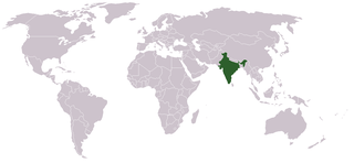
Location map for w:India.
User:dbenbenn modified Image:BlankMap-World.png.
منښتليک:
| |
This work has been released into the public domain by its author, Vardion, at the انګليسي ويکيپېډيا project. This applies worldwide. In case this is not legally possible: |
د دوتنې پېښليک
په يوې نېټې/يوه وخت وټوکۍ چې د هماغه وخت او نېټې دوتنه چې څنگه ښکارېده هماغسې درښکاره شي.
| نېټه/وخت | بټنوک | ډډې | کارن | تبصره | |
|---|---|---|---|---|---|
| اوسنی | ۰۷:۳۵, ۱۱ سپټمبر ۲۰۲۱ | | ۱٬۳۵۷ × ۶۲۸ (۲۱ کيلوبايټ) | Ytpks896 | Reverted to version as of 22:39, 12 February 2005 (UTC) |
| ۱۳:۳۷, ۲۹ جولای ۲۰۲۱ |  | ۱٬۴۲۷ × ۶۲۸ (۱۰۳ کيلوبايټ) | Ytpks896 | Reverted to version as of 03:16, 1 May 2008 (UTC) | |
| ۰۰:۳۳, ۱۵ فبروري ۲۰۱۰ |  | ۱٬۳۵۷ × ۶۲۸ (۲۴ کيلوبايټ) | King Zebu | Reverted to version as of 09:17, 3 June 2005 Please discuss before making such edits in future. | |
| ۰۳:۱۶, ۱ مې ۲۰۰۸ |  | ۱٬۴۲۷ × ۶۲۸ (۱۰۳ کيلوبايټ) | KAVO | (Changed to colours more noticeable: *Light green - Claimed by India, not administered by India **(Aksai Chin, Azad Kashmir, Northern Areas, Shaksgam Valley) *Deep Green - Disputed with other nations, administered by India **(Arunachal Pradesh, Jammu and | |
| ۰۹:۱۷, ۳ جون ۲۰۰۵ |  | ۱٬۳۵۷ × ۶۲۸ (۲۴ کيلوبايټ) | Nichalp | NPOV map, please discuss any changes with me for NPOV status | |
| ۲۲:۳۹, ۱۲ فبروري ۲۰۰۵ |  | ۱٬۳۵۷ × ۶۲۸ (۲۱ کيلوبايټ) | Dbenbenn | higher resolution version, without black border | |
| ۲۰:۲۸, ۵ ډيسمبر ۲۰۰۴ |  | ۲۵۰ × ۱۱۵ (۱۸ کيلوبايټ) | EugeneZelenko | Location map for India.<br/>Originally created for English Wikipedia by Vardion.<br/>{{GFDL}} |
د دوتنې کارېدنه
دا لاندينی مخ د همدې دوتنې سره تړنې لري:
د نړېوالې دوتنې کارېدنه
همدا دوتنه لاندينۍ نورې ويکي گانې کاروي:
- په ar.wikinews.org کارونې
- په ckb.wikipedia.org کارونې
- په en.wikipedia.org کارونې
- په en.wikinews.org کارونې
- په en.wikivoyage.org کارونې
- په en.wiktionary.org کارونې
- په fr.wikinews.org کارونې
- په fur.wikipedia.org کارونې
- په he.wikivoyage.org کارونې
- په hr.wikipedia.org کارونې
- په hr.wikiquote.org کارونې
- په incubator.wikimedia.org کارونې
- په ko.wikipedia.org کارونې
- په li.wikinews.org کارونې
- په pam.wikipedia.org کارونې
- په pl.wiktionary.org کارونې
- په pt.wikivoyage.org کارونې
- په pt.wiktionary.org کارونې
- په sr.wikibooks.org کارونې
- په sv.wikinews.org کارونې
د دې دوتنې نورې نړېوالې کارېدنې کتل.